How to get to Byron Glacier Trail
Planning Your Journey to Portage Valley: A Guide to Reaching Byron Glacier
Reaching the remote reaches of the Chugach National Forest requires deliberate logistical planning. The Portage Valley sits at the end of a glacially carved isthmus where regional infrastructure abruptly ends against sheer rock walls and deep water. Accessing the Byron Glacier Trail is not a matter of simply boarding a city bus. Visitors must navigate a specific 60-mile corridor south from Anchorage, managing coastal weather patterns, high-volume summer traffic, and dead zones in cellular coverage. Whether you are arriving directly from a cross-country flight or disembarking from a Gulf of Alaska cruise, securing reliable ground transportation is the critical first step for your expedition.
Before leaving the city limits, drivers need to ensure their vehicles are prepared for the isolation of the valley. There are no gas stations, service garages, or convenience stores once you turn off the main highway. Fueling up in Anchorage or Girdwood is a mandatory prerequisite. Understanding the precise distances and driving conditions will dictate your schedule, particularly if you are trying to coordinate your arrival with the optimal lighting for photographing the ice fields.
Getting There by Car: The Scenic Drive from Anchorage and Girdwood
The drive toward Byron Glacier represents one of the most geographically complex stretches of pavement in North America. The majority of travelers originate their trip at Ted Stevens Anchorage International Airport (ANC). Securing a rental car directly at the airport’s centralized facility—located immediately across from the South Terminal—is the most reliable method for exploring the region. Standard daily rates fluctuate drastically, typically running between $80 and $150 depending on peak summer demand. From the airport, drivers will navigate east along International Airport Road, merge south onto Minnesota Drive, and eventually connect with the Seward Highway (AK-1 S).
Once on the Seward Highway, the route traces the edge of Turnagain Arm. This 50-mile coastal stretch demands absolute driver attention. The roadway is flanked by the sheer cliffs of the Chugach Mountains on the left and the turbulent, tidal waters of the Pacific Ocean on the right. Rockfalls are frequent, and sudden stops by other motorists attempting to photograph Dall sheep on the cliffs cause numerous rear-end collisions annually. At Mile 79, drivers will reach the Portage Glacier junction. Turn left onto Portage Glacier Road. You will follow this winding, two-lane road for exactly 5.5 miles. Watch for the designated signs indicating the Byron Glacier Trailhead on your right, positioned shortly after the Begich, Boggs Visitor Center.
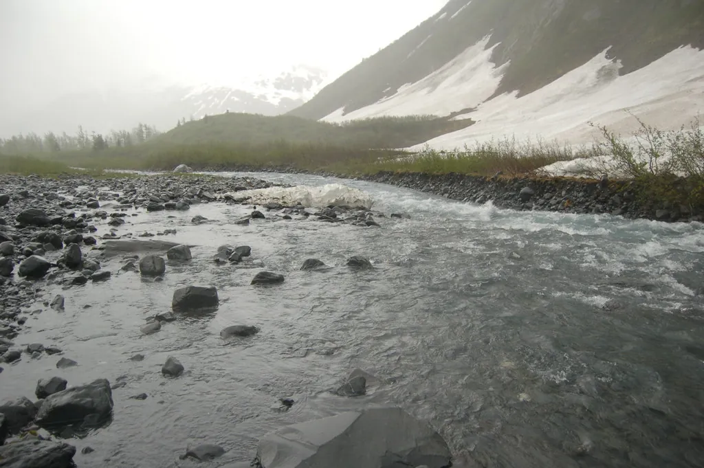
For visitors utilizing Girdwood as a basecamp, the commute is drastically reduced. Located just 12 miles north of the Portage Valley turnoff, Girdwood allows hikers to reach the trailhead in under 20 minutes. Navigating past teh mudflats of the upper arm, locals often make the short drive during the early morning hours to secure parking before the Anchorage crowds arrive. The parking lot at the Byron Glacier Trailhead consists of a moderately sized, unpaved gravel expanse. Parking is currently free of charge, with no day-use fee required, but capacity is strictly limited to roughly thirty vehicles. During peak weekends in July and August, this lot reaches maximum capacity by 10:00 AM. Oversized recreational vehicles and large travel trailers will find maneuvering difficult when the lot is full, often forcing drivers to park along the narrow road shoulder.
Always verify current transit restrictions and active construction zones by checking Alaska 511 before putting your vehicle in drive. Highway delays can easily add an hour to your transit time.
Cruiser Logistics: Disembarking at the Port of Anchorage or Whittier
Cruise passengers face a distinct set of logistical hurdles. If your ship docks at the Port of Anchorage (Ship Creek), you are deposited into a heavy industrial zone that lacks immediate consumer infrastructure. There are no rental car kiosks waiting at the gangway. Passengers must either secure a pre-arranged transfer or walk 15 to 20 minutes uphill into downtown Anchorage to reach the commercial rental agencies clustered near 5th Avenue. A local taxi from the port terminal to a downtown rental office costs roughly $10 to $15. Do not attempt to hire a standard taxi for the entire 55-mile journey to the glacier; one-way fares routinely exceed $250, and because cellular service evaporates in the valley, you will be entirely unable to summon a return ride.
For those disembarking in Whittier, the situation is different. Whittier is located on the Prince William Sound side of the mountains, connected to the Portage Valley by the Anton Anderson Memorial Tunnel—a 2.5-mile, single-lane toll tunnel shared by trains and cars. If you are exiting a ship in Whittier, booking a dedicated transit excursion like the Whittier to Anchorage Cruise Transfer & Wildlife Tour is highly advised. These specialized shuttles navigate the strict, alternating tunnel schedule and frequently incorporate guided stops in the Portage Valley before continuing north to Anchorage.
| Departure Point | Distance | Estimated Time |
|---|---|---|
| Anchorage (ANC Airport) | 60 miles | 1h 15m – 1h 30m |
| Girdwood | 15 miles | 20 minutes |
| Port of Anchorage (Ship Creek) | 55 miles | 1h – 1h 15m |
| Whittier Cruise Terminal | 6 miles (Via Toll Tunnel) | 45 minutes (Dependent on tunnel schedule) |
Navigation and Transit Realities
Public Transit & Rideshare
Public transit to the trailhead is non-existent. The Anchorage People Mover bus system terminates strictly within the city’s municipal boundaries. While regional motorcoach services like the Park Connection drop passengers at Girdwood, they do not detour into the Portage Valley. Rideshare applications (Uber and Lyft) operate within Anchorage but are completely useless for this specific day trip. Drivers will drop you off, but the total absence of cellular infrastructure at the trailhead means you cannot ping a driver for the return journey. For those who choose not to rent a car, securing a seat on a guided excursion like the Glaciers and Wildlife: Super Scenic Day Tour from Anchorage guarantees round-trip transportation while eliminating the stress of highway navigation.
GPS & Offline Maps
Your smartphone will lose its connection to cellular towers precisely at the Mile 79 junction. Once you turn onto Portage Glacier Road, you are driving completely off the digital grid. Relying on an active data stream for turn-by-turn directions will result in a blank screen. Visitors must download Google Maps offline areas or cache their preferred topographic maps while still connected to Wi-Fi in Anchorage or Girdwood. Dedicated satellite GPS units are highly recommended for those planning to push past the maintained trail and scramble the rocky moraines near the ice base. Without offline data, it is a navigational blind spot you don’t want to get stuck in.
Can You Reach the Trailhead by Boat?
A common misconception among out-of-state visitors involves aquatic access to the glacier. The physical reality of the valley geography makes this impossible. While Portage Lake dominates the center of the valley, and the commercial vessel mv Ptarmigan operates daily cruises across its surface, this boat does not provide access to the Byron Glacier Trailhead. The vessel is designed exclusively to ferry passengers to the face of Portage Glacier at the far end of the lake. The trailhead you are seeking is located on an entirely different drainage system, requiring ground transport via the paved road. Review our Trail Map, Distance & Conditions guide to understand the exact topographical layout separating the lake from the trail.
Connecting Your Trip: Highway Stops and Regional Context
Maximizing your time in the region means understanding what lies adjacent to your primary route. The junction at Mile 79 is not just a turnoff; it is the exact location of the Alaska Wildlife Conservation Center. This 200-acre sanctuary rehabilitates orphaned brown bears, moose, and wood bison. Allocating two hours to drive the sanctuary’s internal loop provides an excellent educational precursor to the wild environments you will encounter on the trail.
Further north along the highway, the pull-offs lining Turnagain Arm offer exceptional opportunities to spot beluga whales riding the incoming bore tide. Beluga Point and Bird Point are mandatory stops for photographers. If you prefer to have the itinerary managed by local experts who know the precise timing of the tides, consider booking a Full-Day Tour in Turnagain, which pairs transportation with historical commentary. For independent drivers, compiling a list of these specific geographical markers is essential. Consult our comprehensive breakdown of the Best Stops Along the Seward Highway to sequence your drive logically.
Whenever pulling over at unmarked scenic shoulders, drivers must maintain situational awareness. The forested edges of the highway are active wildlife corridors. Familiarizing yourself with Understanding Bear Country Etiquette is non-negotiable, even when you are just stepping out of your vehicle to snap a quick photograph of the mudflats.
Seasonal Road Conditions and Winter Access
The calendar dictates the severity of the drive. From May through September, the Seward Highway and Portage Glacier Road are clear, paved, and heavily trafficked. Summer driving requires patience rather than technical skill, as motorhomes and commercial coaches slow the flow of traffic.
From October through April, the transit reality shifts dramatically. The coastal mountains trap heavy precipitation, burying the valley in deep snowpacks. While the State of Alaska plows Portage Glacier Road, the surface frequently glazes over with black ice due to the dropping temperatures and freezing fog coming off the lake. Vehicles lacking all-wheel drive or dedicated studded winter tires will spin out in the trailhead parking lot. Furthermore, the steep ridges flanking the road are known avalanche chutes. Temporary highway closures for avalanche mitigation via artillery fire are standard winter occurrences. Review our Seasonal Guide: Summer vs. Winter to determine if your vehicle is appropriately equipped for the current conditions, and always read our Ice Caves & Avalanche Safety protocols before driving into a known slide zone.
The Seward Highway is prone to sudden weather changes. Even in summer, mountain passes can experience fog or high winds. Drive with your headlights on and maintain a safe following distance.
Preparation and Final Safety Checks
Your successful arrival at the Byron Glacier Trailhead hinges on respecting the isolation of the Chugach Mountains. Transportation here is not a passive experience; it requires active hazard management. Confirm your rental vehicle has a full-size spare tire rather than a temporary donut. Pack an emergency roadside kit containing thermal blankets, extra water, and signaling flares—even in July. The coastal environment punishes unprepared motorists. For a broader perspective on surviving and thriving in this rugged terrain, study our Safety Essentials for Alaska Hiking.
Once you secure your vehicle in the gravel lot, the logistical challenges end and the physical exploration begins. Lock your doors, verify you have packed out all scented items from the passenger cabin to deter curious wildlife, and consult our Visitor Rules & Guidelines to ensure your time on the ice adheres to conservation standards. The glacier awaits just a short distance up the valley floor, rewarding those who navigate the journey with precision and preparation.
For travelers looking to bypass the complexities of driving entirely, head over to our Tickets & Tours page to browse professionally chauffeured excursions that handle all highway logistics, allowing you to focus entirely on the ancient ice formations and the towering peaks of the Portage Valley. Exploring the Glacier Science & Wildlife is far more enjoyable when you aren’t fatigued from navigating an unfamiliar coastal highway.