Top Day Hikes Near Anchorage
The Anchorage Advantage: A Hiker’s Staging Ground
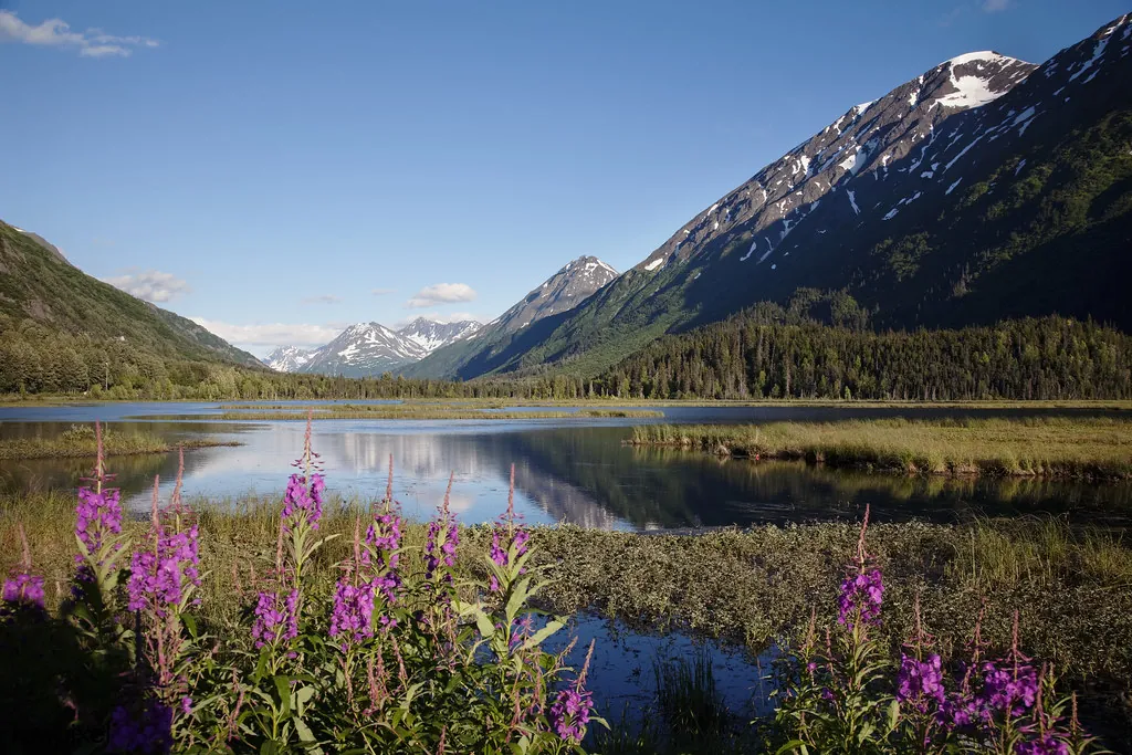
Anchorage sits on the edge of a severe geologic collision, framed by the tidal mudflats of Cook Inlet and the sheer granite walls of the Chugach Mountains. You do not need to charter a floatplane to experience Alaska’s formidable topography. Within a two-hour driving radius, hikers can access alpine tundra, hanging glaciers, and dense coastal rainforests. Southcentral Alaska operates as an unparalleled basecamp for outdoor ambition, where a single paved highway connects a major metropolitan center directly to half-million-acre wilderness preserves. Building a proper hiking itinerary requires understanding the distinct microclimates surrounding the city. Heading north toward Eagle River and Eklutna introduces hikers to drier boreal forests and steep, wind-scoured ridges. Driving south along Turnagain Arm plunges you into a maritime weather system where heavy precipitation feeds massive ice fields and temperate rainforests. This regional diversity means you can scale a dry, rocky summit in the morning and stand beneath a dripping ice cave by late afternoon.The Crown Jewel: Byron Glacier Trail
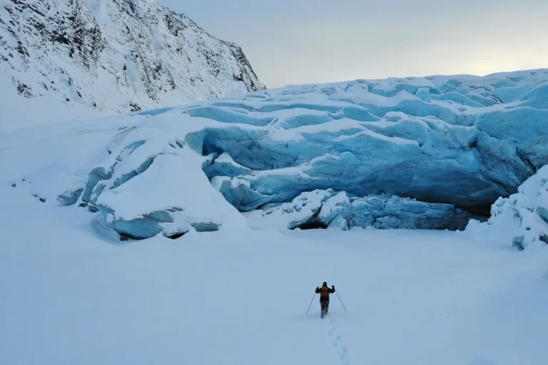
Portage Valley contains some of the most dramatic glacially carved landscapes in North America, and Byron Glacier Trail remains the most efficient way to interact with this terrain. The route tracks the glacial meltwater of Byron Creek, cutting through alder thickets before opening into a stark, rocky basin. It provides the closest glacier view to the city without requiring crampons or technical mountaineering experience. Byron Glacier stands as an anomaly in the landscape of high-effort Alaskan mountaineering, remaining entirely acessible to casual walkers. You drive down Portage Glacier Road, park the car, and walk a relatively flat 2.8-mile round trip over a maintained gravel path. For visitors prioritizing time, booking a Glacier View & Wildlife Anchorage Adventure Tour eliminates the driving logistics while ensuring you reach the prime viewing boulders near the ice field’s base.Southcentral Alaska operates as an unparalleled basecamp for outdoor ambition, where a paved highway connects a major metropolitan center directly to half-million-acre wilderness preserves.
Quick Comparison: Top Anchorage Day Hikes
| Trail Name | Distance (RT) | Difficulty | Best For |
|---|---|---|---|
| Byron Glacier | 1.4 miles | Easy | Glacier Views & Accessibility |
| Flattop Mountain | 3.0 miles | Moderate/Hard | City Panoramas & Summit Scrambles |
| Thunderbird Falls | 2.0 miles | Easy | Family Walks & Waterfall Photography |
| Winner Creek | 6.0 miles | Moderate | Rainforest Environments |
| Mount Baldy | 2.5 miles | Hard | Steep Elevation & Inlet Views |
Flattop Mountain: The Iconic Summit
Rising directly above the Anchorage bowl, Flattop Mountain serves as the most heavily trafficked summit in Alaska. The trail begins at the Glen Alps Trailhead inside Chugach State Park, immediately subjecting hikers to a relentless upward grade above the timberline. The initial miles consist of wooden stairs and switchbacks cut into the mountainside, offering sweeping views of the city skyline long before you reach the peak. The final ascent shifts from a standard hike to a physical scramble over jagged scree and large boulders. Hikers must use both hands to navigate the steep, rocky chute just below the summit. Once on the plateau, the 360-degree vantage point reveals the sprawling mass of the Alaska Range to the north and the treacherous tidal waters of Turnagain Arm to the south. It is a demanding 3-mile round trip that requires sturdy footwear and a strong tolerance for high winds at elevation.Thunderbird Falls: Coastal Boreal Beauty
Located just north of the city via the Old Glenn Highway, Thunderbird Falls provides a stark contrast to the grueling alpine climbs of the Chugach. This 2-mile round trip follows the Eklutna River gorge through a dense forest of paper birch and white spruce. The path is a wide, undulating dirt track that accommodates all skill levels, making it a staple recommendation from Visit Anchorage for families traveling with young children. The trail splits near the end, offering two distinct perspectives of the 200-foot waterfall. The upper boardwalk leads to an established viewing deck suspended over the gorge, providing a clear vantage point of the water cascading over exposed bedrock. The lower, unmaintained spur trail drops sharply down to the creek bed, allowing hikers to stand directly in the misty updraft of the falls. Spring melt turns the creek into a roaring torrent, while winter freezes the falls into a massive, sculptural column of blue ice.Winner Creek Trail: The Rainforest Corridor
Driving south to Girdwood places you in the northernmost stretch of the Pacific temperate rainforest. Winner Creek Trail begins near the base of Mount Alyeska, instantly immersing hikers in an environment dominated by towering Sitka spruce and western hemlock. Thick carpets of sphagnum moss cover the forest floor, and the air carries a heavy, damp quality characteristic of the Chugach National Forest. Winner Creek is the trail most locals bring their visiting relatives to. The route follows the turbulent waters of Winner Creek as it carves through a narrow rock gorge. Wooden boardwalks elevate hikers over the muddiest sections of the 6-mile round trip. Historically, a hand-tram allowed hikers to pull themselves across the gorge in a metal cage. Even when the tram is non-operational, the sturdy wooden bridge over the lower creek crossing offers phenomenal views of the churning whitewater below. You can easily pair this hike with a guided Turnagain Arm Tour to maximize your day south of the city.Mount Baldy: The High-Altitude Challenge
Mount Baldy looms over Eagle River, presenting a short but punishingly steep ascent. Clocking in at roughly 2.5 miles round trip, the trail wastes zero time on switchbacks, opting instead for a direct, vertical push up the mountainside. The path is heavily braided with loose dirt and exposed roots in the lower section, requiring careful foot placement to avoid slipping. Breaking out of the tree line happens quickly, exposing hikers to the raw elements of the ridge. The final stretch requires a solid push up teh main ridgeline, where the wind frequently reaches gale-force speeds. Those who endure the climb are rewarded with an uninterrupted view of the Eagle River Valley cutting deep into the interior mountains, alongside a commanding overlook of the Knik Arm stretching back toward Anchorage.Rabbit Lake Trail: Wildlife and Wilderness
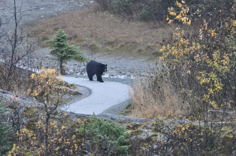
For hikers seeking distance rather than extreme vertical gain, the Rabbit Lake Trail delivers an 8.8-mile round trip straight into the heart of the Chugach front range. The trail originates at the end of Upper Canyon Road, tracing the contours of a massive glacial valley situated between McHugh Peak and the jagged ridgeline of Suicide Peaks. The sheer scale of the landscape dwarfs hikers as they follow the old roadbed deep into the wilderness. The trail remains relatively flat, slowly gaining elevation as the brush recedes into low-lying alpine tundra. This open terrain provides excellent visibility for spotting Dall sheep navigating the high cliffs and moose grazing in the valley floor. The hike terminates at Rabbit Lake, a pristine, high-alpine body of water trapped in a steep mountain bowl. High winds frequently whip across the surface of the lake, making a sturdy windbreaker essential for anyone planning to sit and enjoy the view.Strategic 3-Day Hiking Itinerary
Maximizing your time in Southcentral Alaska requires grouping hikes by geographic zones. Bouncing wildly between Eagle River and Portage will leave you exhausted and trapped behind an RV convoy on a two-lane highway.- Day 1: The Anchorage Bowl. Begin your trip by tackling Flattop Mountain early in the morning to beat the crowds and secure parking at Glen Alps. Spend the afternoon recovering with a flat, scenic walk around the Tony Knowles Coastal Trail.
- Day 2: The Deep South. Dedicate an entire day to the Turnagain Arm corridor. Review our guide on Best Stops Along the Seward Highway to plan your drive. Arrive at Portage Valley to hike the Byron Glacier Trail, utilizing the afternoon to explore the surrounding lakes.
- Day 3: The Rainforest Retreat. Drive down to Girdwood and tackle the Winner Creek Trail. The dense canopy provides excellent shelter if the coastal weather turns rainy.